
Around halfway between Gold Beach to the east and Sword Beach, which formed the left-
When the first assault landed at 07:55 the tide was rising and the beach obstacles were partially submerged, making it difficult for the engineers to clear the way and leading to problems in landing.
Around 30% of the landing ships at Juno were destroyed or damaged by mines on the beach and once the troops began moving inland, the German guns took a terrible toll.
However, in spite of facing heavy and fierce opposition at Courselles-
By evening, Canadian troops had linked up with British troops from Gold Beach to the west, but there was still a gap between the Canadians and the British forces landing on Sword Beach to the east.
This allowed the Germans to orchestrate a counterattack by the 21st Panzer Division.
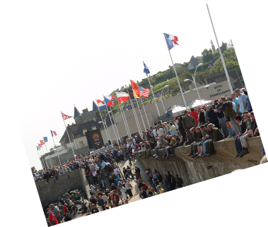
Bunkers can still be found today along Juno’s coastline, in particular the bunker outside of the museum, the Juno Beach Centre.
Dedicated to showcasing the Canadian involvement in WW2 at Juno Beach, the museum’s courtyard features a memorial entitled Remembrance and Renewal by Canadian sculptor Colin Gibson.
The Maison de Queen’s Own Rifles, a house on the beach which was possibly the first house on French soil to be liberated by the Allies, is today a memorial to the Canadian Queen’s Own Rifles who liberated it in the first wave of attacks on June 6th 1944.
The house appeared in many of the official photographs and newsreels of the landings.